Tuesday, August 31, 1982

1982 Heading Home (8/29-31/1982)

Sunday, August 29, 1982
After a breakfast of bacon and eggs, and toast, we went to buy some groceries for Kathy’s Grandma. We left about 9:30 on a pleasant sunny day, heading home! We took Interstate 71 out of Louisville up to Cincinnati and Columbus. I took over driving and we bypassed Cleveland on I 271. Once on I 90, we kept an eye out for a large stone church of which Kathy wanted a picture. When we saw it we planned to take the next exit, but there wasn’t an exit, so no photo.
Everyone slowed going into Pennsylvania, since the state troopers were out in force. In New York, we picked up a toll ticket, and everyone was still going 55 mph! But things picked up. After paying the $1.65 toll, we left the Thruway on NY 33 into Buffalo. We arrived at my house at 19:30. We unpacked all my things from her car, and sorted out the Oregon Coast seashells and a few rocks, and I ended up with al the leftover food. In fifteen minutes Kathy was on her way home to Syracuse.
The starting mileage was 30,233 and ended at 42,727 for a nearly 12,500 mile trip. Our itinerary weaves a bit on the map, but manages to cover quite a lot of territory; 26 states and 4 provinces. Maybe we should call it Criss-crossing America!
1982 Crossing America
For me, I could add 23 new states and 4 provinces to my checklist!
I was able to watch many of my slides that had already come back from processing.

Monday, August 30, 1982
I began cataloging the trip slides, paying bills, etc. Our Jasper Chateau bill came to 88 US dollars.
Took Frank downtown to get his working papers, and later picked up Terry. Went to Delaware Camera to buy slide cases and to see about having my camera repaired. Terry is going to take my manual Minolta and it is getting cleaned. They could not estimate repairs on the auto Minolta, so I will leave it with Mommy to have her friends in Suffern see about getting it repaired at Minolta in Ramsey, NJ.
Later I was able to negotiate with Terry to borrow her Fujica while my Minolta was being repaired.

Tuesday, August 31, 1982
Finished cataloging the slides. Went shopping for a black traveling bag, but couldn’t find what I wanted at Eastern Hills Mall, Boulevard Mall, or Northtown Plaza! I looked into buying a pocket-size 35mm camera, but was not thrilled by them.
The cross country trip is officially over; soon back to work (in Switzerland!)

Saturday, August 28, 1982

1982 St Louis and Louisville (8/27-28/1982)

Friday, August 27, 1982
Up early to see Karen before she left for work, had English muffins for breakfast, packed up, said goodbye to the three cats (one of whom Kathy invited to our bed last night!), and started off. We stopped at a bank that wasn’t open yet, but the drive-thru was to allow Kathy to cash travelers cheques. We followed US 34 through the corn and milo fields before heading south on US 73/75 to Nebraska City. Crossed the Missouri River on NE 2, into Iowa and took US 29 south into Missouri.
Missouri seemed to have more hills and trees as we more or less followed the placid Missouri River. In Kansas City we crossed the Missouri River again, and took I 70 headed eat. An uneventful drive except for getting gas and changing drivers. We crossed the Missouri River twice more before pulling into St Louis. We turned south on Rte 270 and joined the rush hour traffic down to US 64. There we turned to exit to Brentwood Boulevard, heading north. We mistakenly turned right on Clayton Road and we were not seeing any landmark street names. We turned north and got back to Brentwood Boulevard, and at last found Bonhomme Avenue, having driven around the perimeter of Clayton, MO. Bonhomme was a street of upper class offices and apartments, and we found the Holiday Inn Clayton Plaza Hotel. We were hoping for the weekend rates of $35 with our $10 discount coupon, plus they have HBO cable TV. But it was orientation weekend at the Washington University, so we paid $56. We went up to our room number 815, which was right across the hall from the noisy ice machine. We checked the HBO schedule, then left to find a place to eat. We took Brentwood Boulevard down past US 61 and wandered through some nice neighborhoods to US 44. We took US 44 into overcast and hazy city of St Louis and could barely see the Gateway Arch. Kathy exited at Grand Avenue and turned north trough a renewing African American neighborhood. We drove past boarded-up buildings to I 70, which we took west until we saw a sign for a Wendy’s and exited. We had chili and a salad. After dinner we took I 70 out to the airport, then south on US 67 to a mall where Kathy wanted to go through a Famous Barn department store. Very ritzy, and the home store didn’t sell needlework anymore! Bought some chocolate fudge ice cream at Baskin-Robbins and drove back to the hotel.

Saturday, August 28, 1982
At 00:10 we turned on HBO to watch the movie “It’s My Turn,” which ended at 1:30.
We left at 9:00 and Kathy called her relatives In Louisville to let them know we were coming. It would take 5-1/2 hours and we told them we would arrive at 15:00. But then we realized we would be entering another time zone, and it would actually be 16:00. So we hurried off, taking US 64 through the still hazy city. We saw the Gateway Arch, but not the Mississippi River as we crossed it. Traveled through Illinois and Indiana, having to swerve around a car slowing at a fork, and then around a police car directing people around a stalled car. Kathy drove and managed to cut an hour off the driving time, so that we arrived in Louisville at 15:00.
We mostly snacked and played our usual car games such a trying to find the alphabet in letters on signs, or objects starting with the letters, or coming up with names through the alphabet. We played 20 Questions about animals, or coming up with place names or animal names starting with the last letter of the previously named animal. We had also made up an operatic story to go along with the Muzak on the radio. Our radio listening was limited because Kathy didn’t like any static and neither of us could listen to country and Western music for too long. We also had been keeping a checklist of state license plates and finally found the rare Rhode Island plate in Louisville. We had even found Hawaii and Alaska!
We arrived at Kathy’s Grandpa G’s and Aunt Elanor’s house. Kathy did an assessment on Grandpa’s swollen leg and then we sat on the screen porch for lemonade and zucchini bread. We saw Eleanor’s very impressive doll collection that filled the attic to overflowing, with displays downstairs as well. All sorts of dolls, and smaller ones were put in display boxes put together by Eleanor with miniatures and handmade things. The attic was full of display cases that were lighted, and some revolved round and round. There was a big neat old doll house, and mechanical dolls, porcelain dolls, etc., etc.
Eleanor also takes a picture and cuts around objects in the picture, lifting them above the surface of the picture to create a three-dimensional effect. Downstairs we looked through a 5” thick loose-leaf notebook of a photo album going back to Kathy’s great-great-grandparents on her mother’s side. Eleanor had photographed old pictures and put together three of these notebooks for herself, her brother, and her sister who is Kathy’s mother.
It was time to drive to the nursing home to feed Grandma G her supper. Her area of the 3-bed room was crowded with cards and pictures, handmade mobiles, and stained-glass suncatchers in the window. While Grandma quietly ate, her roommate screamed. After an ice cream treat, we drove to the other side of Louisville to Kathy’s Grandma C’s house. There we met the spry 80-year old, and Kathy’s Uncle George and his wife Joyce G, as well as the Yorkshire terrier Cyndie.
We went too Danner’s restaurant for dinner, all seven of us! We had to wait a while for a table at the family style restaurant. We all had the soup and salad bar, and most of the others got spaghetti. I had the fish sandwich that came in inch-thick bread. I couldn’t eat it as a sandwich, or even an open-face sandwich! I ate the fish and the bread separately!
We drove back to the C's for a picture taking session, then George and Joyce left, and later the other Gs. I wrote in the journal as Kathy talked with her grandmother, and we went to bed there at 23:30.
Next: Heading Home.

Thursday, August 26, 1982

1982 Lincoln, Nebraska (8/26/1982)

Thursday, August 26, 1982
Finally went to sleep at 1:30 and up at 9:00. Apparently Kathy slipped and did a split in the bathroom, but because of her long legs, her feet stopped at the door and wall at only a 90 degree angle! We stopped at a stained glass window shop. Then we used one of our coupons to get breakfast at Burger King, just making the cutoff before lunch. Ate while on the road, following Interstate 35, leapfrogging with a car full of businessmen and passing wheat fields. Joined US 81 continuing north into Nebraska, and had a detour taking us out of our way along US 136 West, north on NE 5, and back east on NE 4 to US 81. We passed cattle, cornfields, and some funny grain that looked like corn, except the tuft on top was in a pine cone shape rather than a tassel. It was generally shorter than cornstalks and had no ears. The tufts were brownish red to black. We found a stray plant by the side of the road and I got out to cut off the tuft. We later learned from Karen’s neighbor that it was milo, used to feed livestock.
We turned east on I 80, zooming into Lincoln, NE. Exited at West O Street and entered Lincoln over the smelly railroad yards and industrial area. It was a big Midwestern town with mission bums lying on the benches. We passed through downtown and turned right on S 42nd Street into a residential area of nice small houses. Number 727 belonged to our P.T. classmate Karen Knortz. A Chevy flatbed truck was in the driveway with a rowboat on a trailer hitched to it. We rang the doorbell; no answer. We knocked, and a slim and trim Karen answered. She showed us around the house where much of the work was done by Karen and her housemate, Barb. Karen’s new hobbies are photography, and making picture frames and birdhouses. And fishing. The backyard was beautiful.
We had arrived at 15:45 and Karen had just gotten home herself, although we were expected at 15:00. She is working four days a week now at a hospital with a sports medicine clinic, and is teaching and taking classes, gives lectures, fishes, does research at the hospital, etc. As busy as ever.
For dinner, we took Karen out to the steakhouse of her choice. We drove out to Denton, NE and took a gravel road to a nondescript building. Inside it had linoleum tables and booths, a jukebox, and a bar. We each ordered the Denton 10 ounce sirloin steak, which was delicious, being corn-fed beef. Karen had fries, and Kathy and I had baked potatoes, and we shared fried mushrooms. A great meal for only a total of $24! Karen told the waitress we came all the way from New York for the steak!

Outside she howdied a neighbor and asked what the hell this here thing was. That’s how we learned about the milo. We returned to Karen’s house, passing the State penitentiary and the tallest grain elevator in the world. Really big! We passed the zoo and a nicely landscaped park. Back at the house we talked, looked at Karen’s photo albums, met Barb, and went to bed. When we put the cats out, we saw an opossum eating the cat food. So we saw a live opossum instead of always a dead one!
Next: St Louis and Louisville.

Wednesday, August 25, 1982

1982 Oklahoma (8/25/1982)

Wednesday, August 25, 1982
We were awakened by a knock on the door. We asked who was there and were answered by a key in the lock! The door burst open; obviously the chain lock didn’t work! The maid peeked in, then said, “Excuse me, sir!” and closed the door. So we got up and left for the day, stocking up on groceries and filling up with gas. We headed north on Oklahoma State Route 34 through cornfields, cattle pastures, and the occasional oil pumps. We passed through tiny towns that could be and were missed in a blink of the eye. Woodward was a city with all the chain fast food places. We turned east on OK 15 through the shabby residential area, then into an area of businesses like well-drilling and pump repair. We turned north on OK 50, and eventually east on OK 50A to Alabaster Caverns State Park. There were a few campsites and a building where we bought tickets for $1.50 for the caverns tour. It was about 11:15, and the tour was at 12:00. We explored the exhibits of stuffed bats and rocks, and had a picnic lunch. We took a short walk to look for bats who roost in trees, but there weren’t many trees here. We saw huge colorful grasshoppers, probably Dactylotum bicolor/Rainbow Grasshoppers. Kathy spotted a huge lizard, whose body alone was about 6” long. Probably a Crotaphytus collaris/Collared Lizard.
Crotaphytus collaris/Eastern Collared Lizard
As she was taking pictures, we were called for the caverns tour. We were led behind the building and down a hillside to enter a hill in a large cavern opening. The cave was used as a hideout, but never really used by the Indians, probably because of the bats. Bats still roost there and hibernate there during the winter. We learned that gypsum was the rock near the top, but below that is more fine-grained and called alabaster. Where water filtered through the alabaster, translucent selenite crystals had formed. Water carved the cavern, and loose rocks and earthquakes left it a jumbled rocky area. It did not have stalactites and stalagmite formations like limestone caves. We saw the stream below us and a crawfish was spotlighted. A bat flew across the cave, and later a Corynorhinus townsendii pallescens/Western Big-eared Bat hanging upside down was pointed out. We saw several dome areas, imprints of the stream on the ceiling, the Elephant Rock, and the Gun Barrel Tunnel through which visitors once had to crawl. We experienced the cave in pitch-black, saw a Batrachoseps attenuatus/California Salamander (?), a mirror lake, and a Eptesicus fuscus/Big Brown Bat holed up in a crevice. It was a good tour and we enjoyed it despite the scarcity of bats. At the other end, we sat on rough wooden benches on a trailer that was pulled by a tractor and taken back to the main building.
We returned to OK 50 North and then headed east on US 64 to Cherokee from where we followed signs to the Great Salt Plains National Wildlife Refuge. We found ourselves in the middle of the salt plains with a junkyard on one side and clumps of marsh grass all around. We saw few migratory birds at this time of year, and none that we could identify. We climbed a rusting metal observation platform to look down at the graffiti scratched in the salty dirt. Three miles south there was a Selenite Crystal Digging area that was only open on weekends, but we went anyway. We were on a one-lane red dirt road with rickety bridges over streams, with bushed and undergrowth alongside. We saw lots of birds flitting here and there.
At the selenite crystal area, there was a car with a couple old ladies, who were probably waiting for the couple of guys who had climbed under the wire fence and were digging in the sand. We didn’t sneak in, and signs indicated the real digging area was farther in. From here we could see across to the water reservoir which would attract birds. Saw a toad hopping along. Then saw a flock of the smaller Lanius ludovicianus/Loggerhead Shrikes. We returned to US 64 back to Cherokee, then east on OK 11 which took us past the northern edge of the refuge where we saw many Ardea alba/Common Egrets and a few Egretta caerulea/Little Blue Herons in marshy areas. We passed many pastures full of cattle and common egrets; their necks were too long to be cattle egrets.
We began seeing more oil pumps. We turned north on Interstate 35 into Kansas, and began seeing a lot of wheat fields. In Wichita we checked into the AAA Imperial Lodge, where the motel office was like a bank teller window behind glass, speaking through a microphone, and passing money through a drawer. We got a room for about $32 and found it smelled like someone had spilled cologne. We picked up a newspaper and some coupons, and drove to the Towne West Mall. We ate at Arby’s, and left an unused coupon on the counter, which was soon picked up and used by another customer. After wandering this mall, we filled up on gas, and drove to the Towne East Mall! We bought some cookies from the Cookie Factory and milk from McDonald’s. On our way back to the motel, we kept seeing ads for palm readings, special $1, but weren’t interested. We missed the driveway to the motel and saw a drive-in. Decided to stop and get some shakes. The menu was right next to where we parked. Kathy pushed a button and a squawking voice answered, and gave our order. A three-wheeled vehicle pulled in next to us. We felt a little uncomfortable in this neighborhood, and left when out order was finally brought out to us.
Back at the hotel, there seemed to be a conference of wrecker trucks in attendance. Watched some of the “Face of the 80s” beauty contest, but went to bed before a winner was chosen.
Next: Lincoln, Nebraska.

Tuesday, August 24, 1982

1982 New Mexico (8/23-24/1982)

Monday, August 23, 1982 (continued)
Entered New Mexico, and drove and drove. Stopped at a very nice rest stop with clean restrooms and nice landscaping with cacti and yucca plants, and helpful signs (such as a listing of gas stations in Las Vegas, NM)!
We knew our route was following along the old Santa Fe Trail, but we didn’t see any wagon ruts. We turned north on New Mexico State Route 63 through the sparsely treed Santa Fe National Forest and Pecos National Monument. Our goal was to see wildlife and we saw a Wile E Coyote loping across the road ahead. Later Kathy saw a Eremophila alpestris/Horned Lark.
I-25 had turned into US 84/85 and we were joined by US 285. We stayed with US 85 West at Santa Fe to find the AAA Thunderbird Inn.
Thunderbird Inn
Most of the buildings in the area were adobe-like architecture, and all the buildings were no more than 2 stories. It was neat to see medical centers, condominiums and hotels looking like a pueblo! We got a room for about $35. We were about to drive out when a young kid called out “hello!” He was from New York, too!
We went to Pizza Hut and ordered a traditional pizza with pepperoni, sausage, and mushrooms. When it finally arrived, the crust was so thin and crispy, it was like eating a matzo cracker. A Mexican style tortilla pizza? It was different, though tasty. Our waitress was too busty with a mixed up pizza order to bring us the bill, so she sent us the cashier. We had to hand her the tip, because someone immediately took our table.
We went to a drive-thru liquor store to buy a newspaper. Kathy went in, and when she came out she realized she got an Albuquerque paper. So I went in and came out with a weekly paper. The end result was that we didn’t find any good movies to go see. Went to a mall to get a few sundries, then back to the motel. We are way behind in our journals!


Tuesday, August 24, 1982
Slept in until 9:00! We drove back along US 85 into downtown Santa Fe and parked on the main street, paying for an hour in the parking meter.
E San Francisco St at Old Santa Fe Trail
We went into several shops to see beautiful, but expensive Indian rugs and pottery. Kathy saw a rug she liked and it was the size of a welcome mat, for $1200! We arrived at the Santa Fe Plaza, a large square surrounded by the low adobe buildings. The square is the end of the Santa Fe Trail.
We continued to the St Francis Cathedral, which looked like a typical Spanish church.
St Francis Cathedral
Across from it was an interesting adobe Federal Building!
Federal Building
We returned to the Plaza, to the arcade of the Palace of the Governors. In the shade, many Indians had set out their wares for sale; jewelry, pottery, sand paintings, etc.
Indian Market
A few tables were set up in the central park.
We returned to the store of the $1200 rug, where Kathy got permission to take photographs (of “her” rug). I didn’t realize my backpack had been left open, and when I swung around the pack to get my flash, my camera fell out. That was it for my camera! The already finicky camera didn’t work again for the rest of the trip. But Kathy got her pictures, and when the store clerk recommended a certain rug, Kathy just flashed at it!
When we got back to the car, time had expired by only a couple minutes.
We got back on I 25 and headed for Albuquerque, NM. Shortly before the city, we turned off on Tramway Road to enter the Sandia Indian Reservation. The only thing in sight was our goal, the Bien Mur Indian Market, which had a large modern structure for selling the crafts made by local Indians. There was an impressive collection of jewelry, rugs, pottery, moccasins, etc. All very expensive; and there was a Calvin Klein jeans sale! Kathy asked about a fork for weaving, but they didn’t know anything about it. They gave Kathy the address of a crafts shop in Albuquerque. So we headed to the Coronado Shopping Center in town. The mall was huge. When we found the craft shop, they didn’t have these forks. The lady recommended a weaving shop. We wandered a bit in the mall and got turkey subs for lunch.
We drove out to the Village Wools shop, which was at a new address that the craft lady gave us. If we had used the telephone book we would have gone to the old address. Kathy found her fork, plus some wool yarn skeins to buy.
W headed east on Interstate 40, out in sandy scrubby countryside that lasted forever! Stopped at a Stuckey’s for a pit stop and gas. I took over driving and saw a car ahead of me pull off onto the shoulder, then pull back onto the road. We passed a dead cat that we thought was the cause of this maneuver, but then he weaved over the center line, then onto the shoulder again. He was really weaving all over the road, and it took a while before I thought it was safe to pass him. Kathy took down his license plate number. She suggested we take the next exit to find a phone to call the police. But as we neared an exit, we saw a police car that had pulled someone over, and was just pulling back out into the left lane. The car he had pulled over was just starting to pull onto the road when I zoomed up flashing my lights. The car on the shoulder slowed to let me pass, but I kept flashing my lights, trying to get the attention of the cop. I had to speed up to 65 mph, or more! Finally, I caught up to the police car and Kathy and I waved frantically at him. He turned to see us speeding and passing on the right, and gave a friendly wave back! Kathy and I looked at each other! Kathy waved as if to motion pulling over onto the shoulder, and I sped ahead and pulled onto the shoulder. So the cop turned on his lights and pulled in behind us. Kathy jumped out to tell him about the weaving driver and give him the license plate number. The cop thanked us, hopped into his car, drove across the grassy gully-like median strip and sped off. And so it was that we pulled over a police car!
We hoped we hadn’t turned in someone like the governor of New Mexico and got across the border into Texas before the cop could come back after us!
Apparently in New Mexico we were keeping an eye out for good-looking men. We only saw good-looking cars. In Texas we saw plenty of both! Before passing Amarillo, TX, we saw ten Cadillacs standing on end neatly in a row in a field; some millionaire’s idea of PopArt!
We entered Oklahoma and near Elk City we found a AAA Best Western Motel, the Flamingo, and got the last room for $32. We had to drive around the block to get to our room, and made a detour to Hardees to pick up roast beef sandwiches for dinner. Ate as we watched a John Wayne-Sophia Loren movie, Legend of the Lost.
Next: Oklahoma.

Monday, August 23, 1982

1982 Colorado (8/22-23/1982)

Sunday, August 22, 1982
Up at 8:00 and off for the day, following Interstate 25 south. We could see mountains through the clouds to the west. They came nearer and clearer to us as we entered Colorado. We turned west on US 34, passing through the Valentine city of Loveland, CO.
Colorado prairie
We headed up Big Thompson River Canyon, which really reminded me of Switzerland; a tumbling stream in a rocky gorge with trees and growth in the valley. The big difference was the style of the residences, the odd bright green cabins, and the souvenir shops.
We came out into a flat depression, a round valley called Estes Park, once inhabited by Mr. Estes, who moved out when the valley became over-crowded with three families! Now it is a tourist town.
We continued on US 34, climbing up a river canyon until we entered Rocky Mountain National Park at the Fall River entrance, paying $2.
Rocky Mountain National Park receipt
The Fall River Road was closed to traffic, so we continued to Deer Ridge Junction to turn west n Trail Ridge Road, which climbed and climbed on switchbacks right into the heart of the park. At Rainbow Curve we stopped to look down into what we had climbed to reach the tree line.
Rocky Mountain National Park view from Rainbow Curve
There were many Callospermophilus lateralis/Golden-mantled Ground Squirrels and Tamias minimus/Least Chipmunks being fed by tourists, despite prominent signs explaining why you should not feed the wildlife. We think we saw the Neotamias quadrivittatus/Colorado Chipmunk as well. We also saw many of the distinctive gray Nucifraga columbiana/Clark’s Nutcracker birds.
Nucifraga columbiana/Clark’s Nutcracker birds
We continued up and up to stop at the crowded Forest Canyon Overlook.
Rocky Mountain National Park
Forest Canyon Overlook
Rocky Mountain National Park
This park was by far the most crowded park we have been to. Here we could look down into a deep valley and across at some of the tallest peaks in the area. Plus to the southeast was Long’s Peak, the tallest in the park at 14,255 feet.
Long's Peak
This overlook was at the alpine tundra altitude and signs warned you to stay off the plant life, since it took years and years for it to grow. There were areas of restoration under plastic netting. All around us were short, but plentiful and colorful, flowers, and rocks covered with lichen.
Alpine tundra
Alpine tundra
We continued to climb and passed over the highest elevation point of the road at 12,183 feet. After that we began to descend. Stopped at the Alpine Visitors Center when it began to rain, Used the restrooms that had a really rancid smell. Then we saw signs saying these toilets were unique and conservation-minded, using recycled oil instead of water.
The visitors center explained about the tundra, and the plants and animals. The rain let us as we explored the gift shop. We decided to hike up a nearby hill, as Kathy took photos of the tundra plants, which helped slow me down. As we neared the top, I hurried ahead at my “normal” speed, and ended up really out of breath! The trail continued, but we were satisfied of reaching the topmost point at 12,005 feet.
12,005 feet above sea level
Alpine tundra
 Cynomys ludovicianus/Black tailed Prairie Dog
We returned to the car and continued winding downhill, keeping an eye out for those elusive bighorn sheep. Soon we were back down in the forests and drove along at a relatively level rate until we exited the park, without seeing any more wildlife.
US 34 took us alongside Shadow Mountain Lake and Granby Lake, before we turned south on US 40. I took over driving as it began to rain on and off. We climbed up and over mountains before reaching the major highway of Interstate 70. We followed that to Idaho Springs, CO, where we turned north on CO 119 which followed a narrow canyon similar to Big Thompson. However, there were fewer residences and more evidence of mines. Down below I saw some people panning in a stream. We did a lot of winding and climbing over mountains before the final sprint down into Boulder, CO. Boulder was situated in a flat area, but backed by a sheer wall of a mountain ridge. We drove in search of “The Cafeteria” as recommended by Kathy’s father because of its proximity to a prairie dog town in the middle of the city. First we drove past the University of Boulder, a really nice modern campus. It felt like we were leaving town, so we turned around and discovered a pedestrian shopping area. We parked and walked through the neat downtown with its shop and boutiques, and university students. We went into a tiny mall and asked in a bookstore about a restroom. After using them, we returned to ask about this cafeteria. We had checked a phone book and found the only cafeteria was called Furr’s, and we had its address. But the front half of the phonebook was torn out, so we couldn’t look at the city map. The bookstore lady gladly gave us directions. After checking out a few craft shops, we returned to the car to drive to Furr’s Cafeteria. We found it and saw a messy looking field behind it. Because of all the garbage, we found it hard to believe this was the prairie dog town. A man was walking his Afghan dogs across it. We went for a closer look, and did find mounds with a couple freshly dug holes, but no other sign of life. We waited patiently and then Kathy spotted a prairie dog peeking out of a hole, but it immediately disappeared. The friendly climb-up-your-leg prairie dogs that Kathy’s dad had experienced were gone! We tried sprinkling around bits of granola bar, but couldn’t entice anyone to come out.
Decided to go ahead and eat at Furr’s, which had a long line, but it moved quickly. I had fried chicken with potatoes and corn, and milk, and Kathy got slippery buttery spaghetti with sauce and meatballs, a salad, bread, and milk. We managed to totally stuff ourselves, then paid as we left.
We then went on a prairie dog hunt, and found some standing outside their holes. They were alert as we approached, beating their tails furiously. Kathy threw some peanuts and got the interest of one of them. I took several photos. We couldn’t interest any of the others, and our friend soon tired of the peanuts, and they all disappeared. These were definitely the Cynomys ludovicianus/Black-tailed Prairie Dogs. As we drove out, we saw more mounds in an empty lot across the street.
We drove out of Boulder on US 36 heading southeast for Denver. The AAA guidebook sent us down US 287 to the Valley Motel. We had to be buzzed in the door to see the manager who was Japanese and asked if I was. The room was only about $28. We settled in and then got in the car to get a newspaper. We had seen a newspaper sign pointing to a yellow square, which might have been a yellow store across the street.  But then I saw a bright yellow vending machine practically in front of the motel. We pulled around to buy a paper, and hoped no one saw us drive out to get the newspaper!
When Kathy asked the manager about an ice machine, there was none, but the manager got some out of her refrigerator for us.
We were writing in our journals when the air conditioner quit. It was hot so we opened the door, since it was cool outside. We closed it after a while, only to have to open it again. Later Kathy loudly complained, and lo and behold, the air conditioning started up again!

Monday, August 23, 1982
At about 6:30 I heard dripping that got louder and faster. It seems Kathy thought I was in the bathroom ripping up the bathmat. But when I jumped up exclaiming, “What’s happening?” she knew I wasn’t even in the bathroom! We ran in there to find water pouring out of the light fixture and it was leaking over the door and the toilet. We got dressed and Kathy ran to wake the manager. Later, she came to the door to explain the upstairs bathroom had a clogged drain causing the flood. Hmm…
We left almost right away at 7:00 and found ourselves in Denver rush hour traffic, taking I 70 to I 25 south. To our right were the Rocky Mountains and they were getting closer. Up ahead a rock formation jutted up into the air, called Castle Rock. Here, and especially in Utah, towns had their initial(s) painted onto the hill behind their municipality. Castle Rock had a neon star on it.
We continued south and behind a low ridge of hills, but in front of a higher ridge of mountains, we glimpsed the U.S. Air Force Academy. We drove into Colorado Springs and turned west on US 24 to Manitou Springs, and were on a road without any gas stations. We exited the highway in Cascade and found ourselves in a small community. But just before reaching the Pikes Peak Highway, we found a last chance gas station. As we filled up, a man came to ask from where in New York we were from. He was from Cattaraugus County (see, we even know how to spell that!).
We passed Santa’s Workshop to reach the toll booth for Pikes Peak Highway. We were very surprised to learn the toll was $4 per person!
Pikes Peak toll receipt
We paid up and started up the narrow curving climbing asphalt road. Around one curve we got our first look at Pikes Peak. The cloud cover was below us and we had passed through a few wisps. The road was then covered with gravel, and later became a dirt road, as we climbed to 9,000, then 10,000 feet in altitude. We passed a dammed reservoir holding water for all the towns below. We followed the top of the front range with its few evergreens and quaking aspens. Cars ahead of us were crawling. There were water tanks for car radiators along the way. The pamphlet warned of driving and overheating, and also of over-braking on steep grades.
We passed a ski area and switchbacked farther upward. At Glen Cove we stopped at a gift shop/coffee shop to use restrooms. The car was behaving well.
More and more switchbacks, and you could look back on the switchbacks below. We passed the alpine tundra to just bare rock. After that it was relatively easy curves to the top of Pikes Peak. We were at an altitude of 14,110 feet on bare rock. The cog railway tracks also come to the very top, but only a work train was there at this time.
Pikes Peak work train
The tourist trains only run twice a day.
Kathy at the summit sign
View from Pikes Peak
There wasn’t much view as we looked down on clouds, although to the west we saw a hazy valley. There was a brand new memorial dedicated to Olympic athletes, built in 1982. They hadn’t put the eternal flame in the bowl yet.
We headed back down Pikes Peak Highway, keeping a sharp lookout for bighorn sheep, as this was our last chance. As we passed a huge pile of rocks, I spotted one.
Ovis canadensis/Bighorn Sheep
His horns weren’t very big, but we didn’t care. Further inspection of the pile of rocks revealed several others that were mostly heads poking over the rocks. One guy who was lying down seemed to have a red collar. Another bighorn over to one side was standing in silhouette against the sky; photo op!
Later we stopped to look down into the “Bottomless Pit.”
Bottomless Pit view
Kathy spotted a fat marmot. I began getting a terrific headache, but it went away as we descended. We wound down the dirt road that is the site of the Hill Climb Race every year.
After leaving Pikes Peak, we returned to US 25 and headed to Pueblo. Kathy had heard Pueblo was a beautiful city, but it appeared to be very industrial. Continued south along the mountains through typical brush land. Even parts of Colorado are flat and “lifeless”!
Next: New Mexico.

Friday, August 20, 1982

1982 South Dakota (8/20-21/1982)

Friday, August 20, 1982
Headed out of Cody shortly after 8:00 on US 16 and zoomed across the cattle plains. At Greybull, WY US 16 turned south and at Worland, WY it turned east again. We switchbacked across the mountains, following Ten Sleep Canyon.
Having to follow a "Pilot Car" truck
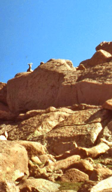
Deer
We saw animals, but they turned out to be more cattle. Often we had to stop and wait for cattle to cross the road. Many meandered across and some stopped to study the yellow stripe before continuing across! In Buffalo, WY we joined Interstate 90. We were listening to a Buffalo radio station, and they were pronouncing the town name the way native Buffalo, New Yorkers would say it.
A long highway through rolling hills of cattle ranches. Somewhere along the way, I yelled out “deer!” taking a few seconds to get out what I really meant: pronghorn. We backed up and now had to use binoculars to confirm that they were Antilocapra americana/Pronghorns. We saw several more groups of pronghorns, interspersed with huge cattle herds, scattered all across the wide plains.
Antilocapra americana/Pronghorns
Pronghorn
At about Gillette, WY, we began seeing signs along I-90 for Wall Drug, but we didn’t give it much thought. At Moorcroft, WY, we turned south on US 16. As we bypassed Newcastle, WY, we smelled an awful stench, like an unbearably strong odor of excrement. Slaughterhouses? It was terrible.
We entered South Dakota and the Black Hills National Forest, where the mountains were thick with forests. In Custer, SD, US 16 turned north, and we turned east on South Dakota State Route 244 to Mount Rushmore. At every curve we craned our necks in anticipation of seeing the memorial, and finally rounded a parking lot to see Washington, Jefferson, Teddy Roosevelt, and Lincoln way up on the face of Mount Rushmore. Pretty neat!
We headed up Alternate US 16 to Keystone, SD, a rinky-dink tourist trap. The AAA motels were already full, so we went to Brookside Motel to get a room for $32. Our room was actually down the street in a duplex house. We parked in the back and had half the lower floor. It was modern and clean, but no bars of soap. Oh, it had dispensers of liquid soap! Kathy took the king-size bed and I took the twin. We went to a restaurant based on the menu left in our room, and it was across town near the aerial tram station and the whirlybird heliport. I had a hamburger with hash browns, and Kathy had a barbecue rib sandwich with fries.
The motel manager had recommended the 3-1/2 minute helicopter ride, so every time the helicopter took off across the street, we timed it. It averaged 3 minutes a trip. I watched the helicopter’s flight pattern, and at one point it seems to hover, then dive down a bit. For the thrill, I guess! There was also a tiny train circling the town, carrying silly tourists.
After eating, we walked around town, stopping in all the gift/souvenir shops. We got some fudge and licorice sticks. The shops sold a lot of typical junky souvenirs, but also lots of gold jewelry made from local gold. The local style of jewelry was rather gaudy. Lots of grape leaves with specks of green and pink sprinkled in. There were also a lot of rocks for sale. Many minerals are mined in the Black Hills, such as gold, silver, copper, and others. At the tiny post office, Kathy called her parents from an outdoor phone booth.
We continued exploring. One shop had a pet tarantula.
We drove back to the motel to write postcards, when Kathy remembered something she forgot to tell her parents. So we found another outdoor phone booth. We kept driving to Mount Rushmore for the evening presentation. There was no fee to park and we found a space. Walked up the path lined with state and territory flags to the visitors center which is cooled and heated by the sun’s energy. From the terrace we could see the stone memorial in the dusk. We walked down the many stairs into the amphitheater and got seats. Darkness fell as we waited. Kathy and I saw a shooting star.
About 15 minutes before the show, a ranger came out to informally answer questions. The fellow was very good, and the questions were even good ones! At 21:00, the ranger said that Teddy Roosevelt was coming to visit with us, and he yelled out, “Teddy, what do you think of Mount Rushmore?”
I looked toward the darkened podium expecting “Teddy” to pop up there, when I was startled by a booming voice in the aisle next to me, shouting, “It’s bully!” A good likeness to Teddy ambled down to the stage to give a half-hour monologue about the four presidents represented and why. Washington: the founding father, Jefferson: the Declaration of Independence and expansion through the Louisiana Purchase, Lincoln: for preserving the Union, and Roosevelt: for bringing the U.S. into international affairs and further expansion, as well as for conservation. We learned a bit about the sculptor, Gutzon Borglum. At one point Teddy was reminiscing and shouted, “Chaaaarge!” which bothered a baby behind us. His finale was to point dramatically at the Mount Rushmore National Memorial which was then lighted up! We tried taking time exposures of the lighted memorial like many others, but unlike the many using flash!
Mount Rushmore National Memorial
We walked up to the area of Borglum’s studio, then back to the car to drive to the motel.

Saturday, August 21, 1982
We left at 8:00 and went practically next door to be the first customers at the Big Thunder Gold Mine. We had to wait for the 8:30 tour after buying the $3.50 tickets and wandering the souvenir shop. A girl unlocked a wooden building and ushered the two of us in. We sat on wooden benches to watch a slide presentation with audio tape narration. It was long and drawn out about the wonders of Keystone. The new town is for tourists, but there is the old town where out motel was, with a general store, school, and working mine. A brief geological survey of the area, then the history (a gold rush of sorts). As soon as the show was over, a man opened a door and told us to go down the path and wait in the shelter. We sat on benches looking at a contraption which turned out to be a hauling machine for vertical mines. The girl came out in a ski jacket with electric lanterns and paper bags. She opened the wooden gate in front of the hole in the cliff, after giving us a brief history of the mine. As we walked into the mine, we were shown a room of explosives, ore cars, and flat sheets on which the ore is dumped to allow easier shoveling than on the rocky floor surface. The mine was in solid rock and did not need supports like a coal mine. We arrived at a room where there was a gold ore vein, and it was explained that there is no such thing as a vein of gold, though a mother lode may seem to be. The veins were of gold ore, rock containing gold that is mined and taken out to be smelted down for the gold. It takes 10 tons of ore to get an ounce of gold!
We were given a hammer and chisel, and a paper bag, and allowed to chip away at the gold ore vein. The ore contained quartz, graphite, iron pyrite (fool’s gold), and hopefully, gold. The room had a curious smell, which the girl said was graphite. Kathy and I were the only “miners” at the time, and the girl conversed with us. After getting a few chips shiny with fool’s gold, we left. In the gift shop, I bought some placers (panned gold flakes). We asked about panning, but you could only do that in troughs, not actually in the stream.
We left the gold mine and drove to the other side of Keystone to the heliport. We saw the options: 1) for kids - the 3-1/2 minute thrill ride, 2) for Mom & Dad - the 7-minute ride, and 3) the comprehensive 20-minute ride. We decided on the cheapest one and plunked out $10 each for the thrill ride. We were ushered out to the Bell helicopter with a bench seat under a large clear bubble. I sat in the middle and Kathy sat next to the clear acrylic door. We were buckled in and noted the stickers on the foot pedals in front of us read: “Not footrests!” The pilot hopped in next to me, revved up the engine, and swoop, we were off! We turned to head to Mount Rushmore a mile away, then turned towards the right. We headed right at a hill, then whoop!, we went up and over for a roller coaster feeling. We turned and hovered, nose slightly down, then dropped down while banking to the right. Whoa! We circled back to the heliport and pivoted for a pinpoint landing. Quite an experience, but one shouldn’t do this ride in order to see Mount Rushmore!
Crooked view of Mount Rushmore from helicopter
We drove to the Mount Rushmore parking lot and walked over to the terrace for daylight photos of the memorial.
Mount Rushmore National Memorial
We wandered through the gift shop which had the typical souvenirs, Indian crafts, as well as Christmas ornaments, and English china. I joked that I was surprised they didn’t have German Hummels. The next counter had Hummels!
We backtracked up US 16 to Keystone and on to Rapid City, SD for a bank stop.
We got on I-90 east, and every quarter mile we saw those billboards for Wall Drug, each offering something different: homemade pie, a 6-ft. rabbit, free maps, free coffee for missile crews, giant dinosaur, art gallery, etc., etc. Some billboards claimed Wall Drug had been written up in various national magazines. So we were convinced that we, too, had to visit the largest drugstore in the world!
We arrived at the parking lot welcoming everyone except airplanes and helicopters! There were several entrances and we managed to pick the one that went into the actual drugstore section. The whole block was taken up with connected buildings full of T-shirts, souvenirs galore, jewelry, western clothing and shoes, postcards, etc. There was a diorama of mechanical dummy cowboy bands and we watched a couple. There were games such as a quick-draw shoot-out with a dummy. A counter full of information brochures, stuffed animals (including a jackalope), food, etc. You could buy one of their small billboard signs to take home. Some people seemed disappointed that it wasn’t as big as they thought. Somehow for me, it was what I pictured, even bigger and better!
We took South Dakota Route 240 south past an abandoned commercial Indian village with a prairie dog town. We saw a few stray prairie dogs among the mounds in the overgrown area.
We paid $1 to enter the Pinnacles area of Badlands National Park.
Badlands National Park receipt
We wondered what Badlands are, just this flat prairie grassland with a few bit of rocks seen on the horizon? We passed several side roads that were not recommended for the ordinary car, being impassable when wet, etc. Then ahead of us, a huge area had eroded, and we saw that the Badlands are below the level of the grasslands! We stopped at a couple points overlooking the eroded areas that looked like dirt hoodoos and needles; pinnacles, I guess! Very delicate and you were warned to keep away from the edges that crumble easily. Farther along were some neat colored layers. So all to one side was the flat grassland, and to the other the land dropped away into the Badlands.
Badlands National Park
Pinnacles Overlook panorama
Panorama Overlook
Panorama Overlook
It was extremely hot so we didn’t stop at every overlook. At the Fossil Exhibit Trail, we took a thermos of ice water to walk the quarter mile. The trail had Plexiglas covered fossils. They weren’t the trilobites that Kathy expected, but mammal bones from a later era. We saw several skulls of early hares, rhinos, and one horse, and a turtle shell. We heard movement in a small bush near a pile of rocks and discovered a frightened cottontail.
We hopped back in the car for air-conditioning and drove past a few areas that actually rose above the grasslands, and exited the park. On I-90, we headed west and saw the all the Wall Drug signs in this direction, before seeing the giant plastic dinosaur in Wall, SD. We stopped for gas and a car wash, which only cleaned off the superficial dirt on the car, not the huge chucks of dirt hanging from the bottom.
Saw herds of cattle and herds of pronghorn. Headed back to Rapid City, then south on SD 79 to US 385 into Nebraska. Al along the way we could see a lightning rainstorm to our left. It was heading in the same direction as we were, but more slowly. The Chadron radio station predicted rain and we could see it was coming!
We turned west on US 20 where it became more hilly, with a lone tree here and there. More clumps of trees meant we were near the Nebraska National Forest. We passed through Fort Robinson State Park, which seemed to be a nicely maintained land around a modern “fort” of the U.S. Army. We planned to get gas in Harrison, NE, but the two stations were already closed. Instead we turned south on NE 29. We saw two cars stopped on the road, one headed in each direction, and as we passed between them, we saw a coiled snake behind the one car. A man was waving at the snake and threw a magazine at him. We hope his intent was to scare the snake off the road so he wouldn’t become road kill.
We entered the gravel road of the Agate Fossil Beds National Monument. We were just ambling along when Kathy swerved and hit the brakes. She had seen a snake, lying there in a wiggily formation across the road. We backed up so Kathy could take a photo from her rolled down window and the snake cooperated by not moving.
Crotalus scutulatus/Mojave Rattlesnake
We noticed the snake flickering his tongue, but he stopped when Kathy wanted a picture of it. She carefully opened her door to gather a few pebbles from the road, and tossed them at the snake. No tongue. So I opened my door and stomped to scare away any snakes under the car (!), and gathered a handful of pebbles. I got in the back seat, but because the back window doesn’t roll down, I had to toss the pebbles out of Kathy’s window. A bit awkward, and I wasn’t helping to alert the snake at all until I accidentally beaned him. Kathy got her picture!
Then for some reason Kathy decided to step out of the car! We had already positively identified him as a Crotalus scutulatus/Mojave Rattlesnake! As soon as Kathy stepped out of the car, the head perked up and whipped his head around in our direction. Kathy was back in the car and rolling up the window in a flash! The snake maintained his new pose.
Crotalus scutulatus/Mojave Rattlesnake with tongue out
We saw a jeep barreling towards us, leaving a lot of dust behind him, so we drove off. Continued through the plains of the Agate Fossil Beds to the visitors center. We knew they had closed at 17:00, but we rushed to the restrooms, hoping they were accessible. Yes, and they were clean and modern, the nicest restrooms so far on the trip! Actually we didn’t quite run to the restrooms because we were on the lookout for rattlesnakes!
They had a self-guided tour through the brush to two hills where animal fossils could be seen, but Kathy decided against the chance encounter with rattlesnakes as the sun set. The pamphlet has a stamp on it declaring “Watch out for Rattlesnakes!” We saw one fossil outside the visitors center, and a cottontail go under the car on her way to the brush.
On our way out, we looked for our first rattlesnake, and found him belly up. Obviously that jeep got him. Headed south on NE 29 as it got darker. Again we saw dark clouds spitting lightning, this time on both sides of us. Some pretty spectacular lightning shows!
We found a gas station to fill up in Mitchell, NE, then headed west on US 26. This time a dark bulky cloud with lightning displays was to the south of us and going our way. We used our imaginations to figure like what particular storm clouds looked.
When we entered Wyoming, we ran into another terrific stink. At Torrington, WY, we turned south on US 85, fearing we would head into that storm. Soon we were surrounded by storm clouds, but above us we could see stars! We hurried along, hitting the tail end of one storm, but missed getting hit by lightning! We saw spectacular streaks going in every direction, and some repeated in the same path over and over. Also saw sheet lightning.
We arrived in dry Cheyenne, WY and found a AAA motel, the Stage Coach Motel, for about $32. We checked in and fell into bed.
Next: Colorado.

Thursday, August 19, 1982

1982 Wyoming National Parks (8/18-19/1982)

Wednesday, August 18, 1982 (continued)
US 89 merged with US 26 as we turned to follow the Snake River east to Jackson, WY. We drove down a main street with lots of traffic and people. Outside a saloon, cowboys and dancing girls in frilly skirts were putting on a preview show to entice you inside. Up ahead there was whooping and hollering, and we had to detour around a Western gunfight.
We found a motel of cabins next to a AAA motel that had no vacancy, and got a half-cabin at Snow King Motel for about $34. It had no air conditioning, but it was getting cooler.
We decided to go to the rodeo, and headed down that main street that was now emptied out. We could see the arches made up of thousands of elk antlers, leading to the town square. We had dubious directions to the rodeo arena, but we found our way and paid the $5.50 general admission to the amateur rodeo. It began to rain and we could see lightning flashing in the distance. We had our raincoats and so were protected from the rain. It soon passed and the clouds cleared for the rest of the rodeo.
The first event was bronco bareback riding, and only a couple guys managed to stay on the required 10 seconds. A few kids were called down and they had to tie a ribbon on a goat’s tail. The bigger goat wouldn’t stay still, but the little goat stood perfectly still! It was funny to see the kids try to straddle the bigger goat to tie on the ribbon. One winner managed to tie a ribbon on the bigger goat when he lifted his tail to do his business!
We saw bronco busting with a saddle; some of the horses looked really mean as they galloped past us. A couple teeny kids rode bucking sheep. There was the calf-roping event, the cowboy had to rope the calf with the lasso and with the horse holding the rope taut, the cowboy jumped off to tie at least three of the calf’s legs together with three loops and a half hitch. If the calf didn’t get loose in 6 seconds, the cowboy’s time was counted. There was bull riding with a rodeo clown in there to help out. One bull didn’t want to leave the arena and turned on the horse sent after him. A dummy sat in the middle and the bull upended him.
Another bull went after the clown and really got him in the seat of his pants with one horn. There was a team calf-roping event. One guy had to lasso the calf’s horns, and the other his two hind feet. They were rarely successful. Another kiddie event was when every kid in the stands was invited down, and they had to chase two calves to grab the ribbons tied to their tails. A mad scramble!
There was only one event with girls/women, the barrel racing. On horseback they had to race around three barrels in a cloverleaf pattern.
They had an injured cowboy routine where the clown was testing the cowboy’s reflexes and kept getting kicked. To revive the cowboy, the clown has his secret invention that looked like a vacuum cleaner. We were shown the secret, which was a skunk inside the canister! At one point the clown ran with the canister and threw a “skunk” into the audience. It was just the fur; the skunk in the canister was real, however!
After about an hour or so, the rodeo was over and we returned to the motel for the night.

Thursday, August 19, 1982
Set off shortly after 8:00 and headed the wrong way on the main drag and found ourselves at the National Elk Refuge.
Teton mountain range from National Elk Refuge
We drove in on the gravel roads in search of elk, but didn’t see a single one! We did get our first good view of the Teton mountain range. We backtracked after coming to a closed gate on the one hand and a farm on the other.
We got back on US 89/26 heading north, and found the other side of the Elk Refuge, but still no elk. We did see lots of Pica hudsonia/Black-billed Magpies. We continued through Jackson Hole, the depressed valley alongside the Tetons. The Teton mountain range seemed to just poke up through the relatively flat land. They were tall and impressive; all over 10,000 feet and some over 12,000 feet. We passed through Grand Teton National Park, being on a flat road running parallel to the mountains. We stayed on the main highway rather than take the local road. We stopped at Cunningham Cabin Historic Site which had a restored dog-trot style cabin, two box rooms covered by one roof with open space between the two rooms. It was made of logs with a thatched roof. You got a small guide for only 15 cents showing why this location was chosen, for the land and the stream. There was a typical fence and foundations of other ranch buildings. The machine wasn’t working, where you were supposed to hear Mrs. Cunningham read a letter. There were Cynomys ludovicianus/Black-tailed Prairie Dogs all over the place, with many coming to us and begging.
We continued north on US 89/26 and at Moran Junction we entered the Grand Teton National Park, paying $2 which would also be good for Yellowstone National Park.
Grand Teton and Yellowstone National Parks receipt
Grand Teton National Park
Kathy at the Cunningham Cabin
Cunningham Ranch
Cynomys parvidens/Utah Prairie Dog
Cynomys parvidens/Utah Prairie Dogs
We were still on US 89 as we passed another big beautiful lake, Jackson Lake. I like the deep colored lakes better than the ice green lakes of Switzerland and Canada.
We soon left the park, but continued to follow the Snake River, winding up a canyon into the mountains.
Snake River
Before we knew it, we were in Yellowstone National Park, full of forested mountains. We rounded a curve and found all the traffic had stopped and people were leaping out of their cars with cameras. We crept along, until we saw the moose ambling in the woods and pulled off the road to take a photo. A real moose! Or at least one in the wild!
Alces alces/Moose
Moose watch
As we rounded another curve, more stopped cars. Yep, more meese! The moose were eating along the marshy sides of a river.
Moose
More moose
A couple moose here, another farther along, another on our side of the road. We continued climbing slowly. The river (Lewis River) was in a small gorge and back on our left I saw some tumbling waterfalls. We came upon Lewis Lake with people fishing from rowboats. Up near West Thumb Lake we stayed with US 89 heading towards Old Faithful. We appeared to be on a flat plateau, and passed a lily-covered Isa Lake. Later up ahead we saw a flat sandy area with a few trees and steam rising. The steam was from Black Sand Basin on the left side of the road, but we headed to Upper Geyser Basin on the right side. The parking lot was said to be full, but we found a spot. We hurried over to the steaming mound where the geyser, Old Faithful, was supposed to blow, and were worried about our timing. But we only had to wait five minutes when Old Faithful blew! It is said to spout water 100-180 feet in the air, but you mostly saw steam, and it lasted for several minutes.
Old Faithful
Old Faithful
Old Faithful
Old Faithful
Old Faithful erupts roughly about once per hour.
Upper Geyser Basin
We went to the visitors center to check on other predicted eruptions, but all would be several hours later. We went to walk around Old Faithful which was still steaming and spitting water. 
Old Faithful from behind
We passed Old Faithful’s runoff and I tested the water which was already cool. There was a faint sulfur smell in the air. We followed a wooden walkway and were warned not to step out on the ground, which might be only a thin crust over boiling water. We saw a couple holes in inch-thick crust. We came to a couple pools of clear light-blue water that boiled and bubbled. An interesting sight!
Chinese Spring?
Blue Star Spring
You could occasionally see the deep dark holes where the water originated. We crossed Firehole River, a seemingly normal river running through this hot bed. But every once in a while you saw steam at an edge, or bubbling where there weren’t rapids.
We walked around the crusty yellow Geyser Hill with more pools and bubbling springs, and spitting and bubbling geysers. I leaned over to feel the water near one geyser, and this time it was really hot!
Upper Geyser Basin
We sometimes heard rumbling, which at times was obviously thunder (a storm with lightning was passing in the east), but otherwise seemed to come from beneath us. Many of the pools were crusted around the edges.
Small geyser
Pool edge
The edge of the Doublet Pool looked like fancy architectural gingerbread, or rough filigree.
Crusted edge of Doublet Pool
Arum Geyser
We passed the Lion Group of four small geysers set up a little off the ground. We followed the river through the woods before coming back to the geyser area again. We saw the Liberty Pool, which seemed to have reddish and white crust with blue water, the colors of the U.S.! The Sawmill Geyser was almost continuously spouting, spraying water all over and up to 20 feet.
Sawmill Geyser
We felt we were awfully close to the spray, but the water cools quickly in the air.
The Spasmodic, Grand, and Turban Geysers were all bubbling and spitting. The Grand Geyser erupts fully twice a day. We continued to the Beauty Pool and Chromatic Pool; truly beautiful.
Beauty Pool reflection
Chromatic Pool
Clear blue water with rings of color around the edges, which is algae. Next were the Giant Geyser and its neighbors, now dormant, although they were spewing bubbling water from fairly big cones.
Bijou, Mastiff, and Giant Geysers
Giant Geyser
As we approached the Grotto Geyser, we saw the skin and bones of some large elk-type animal. We sometimes saw cloven hoof prints in the crusty earth, and several little squirrels were running around.
Elk skeleton?
The Grotto Geyser had a lumpy cone full of holes, and it was steaming and spitting water.
Grotto Geyser
The crust was formed around trees that are now gone, leaving the holes.
We discovered we were a mile from the car. Even though danger of the storm had passed and the sun was out, we decided to head out. We followed the bike path patrolled by a ranger on a bike. Earlier we had seen a ranger on a horse. We passed a steaming field and a couple more pools. We came to the Castle Geyser with its giant cone; it erupts twice a day.
Next to it was the Crested Pool, which was boiling away. We found a couple holes where we could hear bubbling below the earth; if we waited the water would bubble up out of them. Looking back at the Crested Pool, it was now boiling over, bubbling up a couple feet!
Crested Pool
We stopped for some groceries and film, and at the post office for stamps, then returned to the car to drive onward on US 89. Passed another steaming area of Midway Geyser Basin, then stopped at the Fountain Paint Pot. That was really something!
Fountain Paint Pot
Fountain Paint Pot
Fountain Paint Pot
Midway Geyser
Midway Geyser
A huge hole in the ground full of a slowly simmering substance that looked like paint, in shades of white to pale pink. You could watch a bubble form and then burst. We saw a fumarole, which is a dry geyser. Steam was hissing out of the ground, but there was no water. We saw more hot springs, an active spray geyser, and another animal carcass whose skull was farther along the path.
Back on the road, we saw stopped cars and looked for the herd of elk grazing in the woods on the other side of the river. At Norris, WY we left US 89 to head east to Canyon, WY, where the thick forests opened up onto open grasslands. More stopped cars indicated a herd of bison way off in the distance. Saw a lone bison laying on a grassy hill, later a couple more, then one standing in a marshy area.
Passing through Canyon, we followed signs to Inspiration Point to look straight down into the Yellowstone River Canyon with its yellow stone walls!
Yellowstone River Canyon
Much narrower and simpler than the Grand Canyon, but impressive. Kathy and I were out of breath from our little hike up the stairs, and Kathy asked me to take over driving. I continued along the canyon and pulled over at Lookout Point where we were supposed to see both the upper and lower falls. But Kathy had understood that we had to go farther, so we went too the next lookout. We could see into the canyon, but the lower falls just below us were blocked by a jutting rock, and the upper falls were around a bend. Oh, well.
We continued along the Yellowstone River and at one point the smell of sulfur was very strong. We were passing the steaming bubbling Sulfur Cauldron. We crossed the river at Fishing Bridge. Fishing is not allowed at Fishing Bridge!
Drove along Yellowstone Lake which was enormous. On one side of the road was the normal lake. On the other side was the eerie landscape of steaming and bubbling in the streams and pools. We were on a winding road in the mountains again as we left Yellowstone National Park, following US Rtes 14, 16 & 20 along the West Fork Shoshone River.
Bison herd
We were in a fairly wide canyon when we noticed a rainbow. It became more intense and complete, arching from one side of the canyon to the other!
Rainbow
Attempt to Photoshop entire rainbow
Then we saw the second rainbow; a complete double rainbow! We pretty much had it in sight all the way to Cody. WY when it got dark.
We checked into the AAA Mountaineer Motel for about $32. After unpacking, we decided to take in another rodeo. This time we got the more expensive Buzzard’s Roost tickets for $6.
Cody Rodeo ticket
We had to walk all the way around the arena, past a big ugly Brahmin bull-like animal on display, and past all sorts of penned cattle, calves, and horses. We even saw a bison! We had to climb stairs to take a catwalk over the pens to reach the Buzzard’s Roost stands. The other stands were across the arena, but the clowns played to our side. We were behind the chutes and could watch them “chuting” the animals, “saddling” the animals, and see the looks on the cowboys faces as they mounted!
First the bison was sent in, and he rolled a bit in the dirt, then stood patiently as the loudspeaker recited Wyoming and bison history and memories of Buffalo Bill Cody. Then on cue he trotted out again. The U.S. flag was saluted and a girl sang the national anthem in country-western style.
The show began with bronco bareback riding, then with saddles. The animals tonight performed really well; several near-crushed cowboys… Kids had to grab a ribbon from a calf’s tail, and there was a hobby horse race. There was calf-roping, team calf-roping, and calf-wrestling where one cowboy would crowd the calf and another leaped off his horse to grab the horns and pull the calf down on its back.
Next the bull riding. There was quite the commotion below us as the bulls were not cooperating in going into the chutes. One guy got to ride the ugly Brahmin-bull animal. The clown here had a hat cleaning invention where he put his hat on a balloon and blew it up until it popped. The puff of air cleaned the hat. He grabbed a cowboy’s hat and put it over the balloon, and blew the hat to pieces.
The girls did the barrel racing. The Jackson rodeo was smaller, but they had an electric eye for timing the race!
After the rodeo, we went to Dairy Queen: I had a chicken sandwich and Kathy had a barbecue sandwich, both with fries and a shake. We took them back to the motel to eat. The Dairy Queen, like several souvenir shops we have been to, have this composite stuffed animal called a “jackalope,” a so-called mythical creature that looks like a jackrabbit with antelope horns (or deer antlers) and sometimes a pheasant tail.
Next: South Dakota.